
Road-Tripping the American Southwest: Terrain, Timing, and Realistic Distances

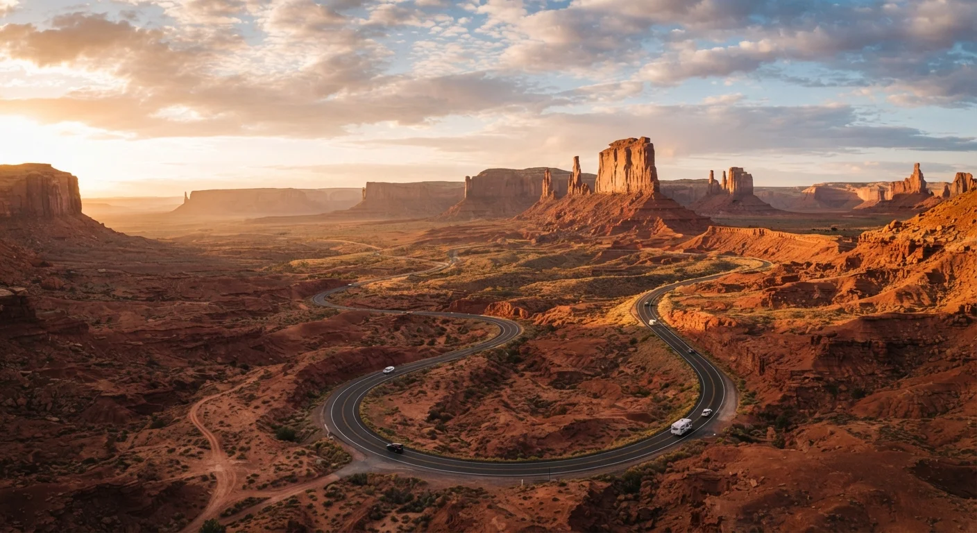
Photo: InsightsTurbo.com | Kickstart Your Knowledge Quest editorial
Key Takeaways
- The Southwest's distances routinely exceed what maps suggest — add buffer time to every driving day.
- Spring and fall offer the most comfortable conditions; summer heat at canyon floors can be dangerous.
- Cell service and fuel can disappear for 50-plus miles between towns — preparation is non-negotiable.
- Permit systems now apply to several high-demand sites; book months ahead during peak season.
- Terrain variety across the region — desert flats, high-elevation plateaus, canyon rims — affects vehicle performance and safety.
Why the Southwest Demands a Different Kind of Planning
The American Southwest — broadly covering Utah, Arizona, Nevada, New Mexico, and parts of Colorado — is one of the most photogenic and geologically dramatic regions on the planet. It's also one of the most routinely underestimated. Young adults who've road-tripped the East Coast or Pacific Northwest often arrive unprepared for the Southwest's specific combination of scale, heat, and sparse infrastructure.
This isn't a region where you can comfortably improvise. Towns with gas stations can be 60 miles apart. Afternoon temperatures in canyon environments regularly exceed 100°F in summer. A trailhead that looks close on a phone map might require two hours of slow driving on unpaved roads. Planning here means engaging seriously with terrain, timing, and distance — before you leave home.
If you're still in the early stages of deciding whether the Southwest is the right next trip for you, our destination research guide walks through how to evaluate a place before committing.
Scope of This Guide
The Core Routes and Realistic Mileage
Most Southwest road trips follow one of a few well-established corridors, each with its own character and practical demands.
The Utah Mighty 5 Loop
Connecting Zion, Bryce Canyon, Capitol Reef, Canyonlands, and Arches national parks, this loop runs approximately 800–900 miles depending on your start point. Driving times on paper look manageable, but slow speeds on Highway 12 (one of the most scenic — and winding — roads in the US) and park entry queues add hours to individual days. Budget at least seven to ten days to avoid rushing.
The Grand Circle
An expanded version of the Utah loop that pulls in Grand Canyon North and South Rims, Monument Valley, and Lake Powell. Total mileage easily reaches 1,200–1,500 miles. This route crosses state lines repeatedly and involves significant elevation changes.
Southwest Desert Triangle
Las Vegas to Grand Canyon South Rim to Sedona and back covers roughly 750–900 miles and suits shorter trips of five to seven days. Highway quality is generally good, but the Rim-to-Sedona stretch through Oak Creek Canyon can be slow.
800–900 mi
Utah Mighty 5 loop minimum distance
Estimated driving distance connecting Utah's five major national parks in a loop, excluding side trips and trailhead access roads.
115°F
Peak summer temperature, Grand Canyon floor
The National Park Service records inner canyon temperatures regularly exceeding 115°F during July and August.
80 mi
Maximum gap between fuel stops in remote areas
Some stretches of southern Utah and northern Arizona have no gas stations for up to 80 miles — longer on unpaved backcountry routes.
Seasonal Timing: When to Go and What to Expect
Timing shapes every aspect of a Southwest trip — from safety to crowd levels to campsite availability.
Spring (March–May)
Widely considered the sweet spot. Temperatures are moderate at most elevations, wildflowers bloom across desert floors, and the light for photography is exceptional. The downside: spring break crowds in March make Zion and Grand Canyon intensely busy, and late-season snowmelt can close higher-elevation roads into April.
Summer (June–August)
Accessible and long-daylight, but genuinely dangerous for canyon hiking. The floor of the Grand Canyon can reach 115°F in July. If you travel in summer, confine strenuous activity to early morning and stick to higher-elevation parks like Bryce Canyon, which sits above 8,000 feet. Monsoon season (typically July–September in Arizona and New Mexico) brings afternoon thunderstorms and flash-flood risk in canyon slots.
Fall (September–November)
A strong rival to spring. Crowds thin after Labor Day, temperatures drop to comfortable ranges, and cottonwood trees turn gold in canyon riparian zones. Roads and facilities remain open through October at most parks.
Winter (December–February)
Underrated by many visitors. Snow on red rock at Bryce Canyon is genuinely striking, crowds are minimal, and campsite reservations are easy to get. Some high roads close, and a 4WD or AWD vehicle becomes useful rather than optional.
Book campsites and permits for peak-season Southwest trips at least three to four months in advance — some lottery systems (like the Wave) open six months out and fill immediately.
Drive Highway 12 between Bryce Canyon and Capitol Reef in the morning when light hits the canyon walls from the east — it's an entirely different visual experience than the afternoon.
Terrain Realities Every Driver Should Know
The Southwest's landscape is spectacular precisely because it's so geologically varied — and that variation has direct practical consequences for driving.
Elevation swings are significant. The South Rim of the Grand Canyon sits at roughly 7,000 feet; Las Vegas is at about 2,000 feet. Engines work harder at altitude, and temperature can drop 30°F between a desert valley and a canyon rim. Layer your clothing and monitor your vehicle's performance.
Unpaved roads are common. Many high-interest sites — the Wave in Arizona's Coyote Buttes, Canyonlands' Needles backcountry, Monument Valley's interior — require driving on dirt or gravel. A standard rental sedan can handle some of these in dry conditions, but a high-clearance vehicle opens significantly more options. Always verify road conditions with the managing agency before you go.
Flash floods are real and fast. Slot canyons like Antelope Canyon and Buckskin Gulch can flood within minutes of a storm that's miles away. Check weather upstream — not just at your location — and follow guide and ranger instructions without exception.
Flash Floods Move Without Warning
Logistics That Catch First-Timers Off Guard
Beyond the driving, a few practical realities define the Southwest experience for first-time visitors.
Fuel planning is essential. In parts of southern Utah and northern Arizona, gaps between gas stations can stretch 50–80 miles on routes that see limited traffic. Keep the tank above half when leaving any town, and carry a physical map as backup when cell service drops.
Permits have transformed access. Several of the Southwest's most famous sites now require advance permits obtained through lottery or timed reservation systems. The Wave, Angels Landing (via chains section), and Havasupai Falls are examples where demand vastly exceeds daily capacity. Research permit requirements at least three to six months out during peak season.
Accommodation is thinner than you'd expect. Gateway towns to major parks — Springdale (Zion), Moab (Arches/Canyonlands), Tusayan (Grand Canyon South Rim) — have limited lodging that books up quickly. Dispersed camping on Bureau of Land Management land is a legal and often beautiful alternative in many areas, but requires knowing regulations in advance.
For a thorough pre-trip checklist covering connectivity, emergency planning, and remote-destination readiness, see our pre-trip readiness checklist.
Building an Itinerary That Actually Works
The most common Southwest itinerary mistake is packing in too many parks. Five parks in five days sounds like efficiency; in practice, it means spending most of your trip in the car and none of your time actually experiencing a place.
A more workable framework: choose two or three anchor destinations and build depth around them rather than chasing a checklist. If Zion and Bryce Canyon are your priorities, spend two full days in each, use a third day to drive Highway 12 slowly, and leave a flex day for weather or spontaneity.
When building your schedule, account for park entry delays (Zion's shuttle-only policy means lines at peak times), the time it actually takes to hike distances at altitude, and the fact that canyon light — the thing that makes Southwest photography extraordinary — happens in the first and last two hours of daylight, not at midday.
Newer travelers will benefit from reading our travel planning from scratch guide before locking in any itinerary. And if the Southwest's national parks leave you curious about less-visited options, parks most people skip offers compelling alternatives with far fewer crowds.
The Two-Day Rule for Canyon Parks
The content provided on our blog site traverses numerous categories, offering readers valuable and practical information. Readers can use the editorial team’s research and data to gain more insights into their topics of interest. However, they are requested not to treat the articles as conclusive. The website team cannot be held responsible for differences in data or inaccuracies found across other platforms. Please also note that the site might also miss out on various schemes and offers available that the readers may find more beneficial than the ones we cover.